Geoscience ANALYST
Leading geophysical software
Geoscience ANALYST is a free 3D visualization and communication software. It allows the display of integrated, multi-disciplinary earth models and data. Geoscience ANALYST Pro provides low cost functionalities for interpretation, targeting, and geophysics.
“This software is great. It accomplishes all the aspects I need to be able to spend more time evaluating and thinking about exploration project data, not fussing over complex software. I have advised a number of exploration colleagues to get going on this software; it continues to be fantastic.”
Todd Keast
P.Geo Consulting Geologist
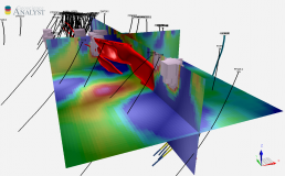
As a unique standalone application allowing users to import, visualize, annotate, save, and distribute a multitude of 3D geoscientific data types and models, Geoscience ANALYST is the ideal companion to a wide variety of 3D exploration and modelling packages. It has an intuitive and modern user interface that is geared toward rapid understanding of complex data. Geoscience ANALYST is set to quickly become your primary means of communicating and disseminating earth models and business decisions based on them.
With Geoscience ANALYST it’s possible to import and share numerous data and model objects including GOCAD Mining Suite objects, and VP Suite models and data. It is also the 3D front end and 3D data set search tool for the Geoscience INTEGRATOR data management system. Its Python API, geoh5py library, allows users to leverage the powerful visualization capabilities of Geoscience ANALYST along with open-source code from the Python ecosystem.
In Geoscience ANALYST Pro is offered a low-cost, easy-to-use interface for object and data editing and creation functionality. ioGAS Link, Drillhole Designer, Maxwell Link, and other functionalities such as geophysical forward modelling, survey design, and unconstrained potential fields inversion are included.
Geoscience ANALYST Pro Geophysics allows advanced geophysical interpretation using VP Suite and the codes developed by the UBC Geophysical Inversion Facility (GIF). It includes unlimited access to VPmg and VPem1D.
More details about the product features available below.
Geoscience ANALYST free viewer
For importing, visualizing, annotating, saving, and distributing 3D geoscientific data and models, this standalone application is perfect.
The product features include:
- Powerful visualization geared towards decision makers and modellers
- An intuitive interface to import data and edit visual parameters
- A quick interrogation of data values, attributes, and histograms via a dynamic link between 3D views and data tables
- The ability to annotate objects and save workspaces for easy distribution and sharing
- Workspaces can be saved and shared as open-format HDF5
- Its Python API allows to manipulate and store a wide range of geoscientific data in geoh5 file format. Get the package on PyPI. Details available in the User guide and demos available on YouTube.
- It imports ASCII, ESRI, images, Geosoft, GOCAD Mining Suite objects, VP Suite models and data (via VPutility), Datamine binaries, ioGAS, UBC-GIF, and DXF/DWG
- GOCAD and .csv file exports
- 3D front end to Geoscience INTEGRATOR data management system
- It is compatible with Microsoft Windows (64 bit) 7, 8 and 10
- It comes with a user guide to walk you through all the features
Geoscience ANALYST Pro
Object and data editing and creation functionality is offered under Geoscience ANALYST Pro. It has effective data analysis, interpretation tools, and utilities. It includes ioGAS Link, Drillhole Designer, Maxwell Link, as well as other functionality for interpretation and targeting. Pro also allows users to perform unlimited forward modelling and unconstrained inversion of potential fields data at no extra cost. “How to” videos are available on Mira Geoscience’s YouTube channel.
Geoscience ANALYST Pro is sold on a 1-year subscription basis. The subscription fee includes a licence for a single installation, technical support, and available updates. In case you need more than 4 single installations, corporate, academic, and non-profit licensing is more advantageous.
- All basic objects (points, curves and surfaces) can be created and edited
- 2D and 3D grid objects can be created
- Drillhole designer to create new drillholes from a collar location with defined lengths, lift, and swing along the path
- Desurvey drillholes to create points
- Surface designer to create surfaces with geometric constraints
- Minimum curvature gridding
- Fourier filtering of 2D grid properties
- Data trend removal for 2D grid and point objects
- Potential fields forward modelling and unconstrained inversion
- Survey designer
- Coordinate system transformations
- Compute and visualize distance to drillholes
Dynamically links to ioGAS. Once linked, any point object in Geoscience ANALYST Pro can be opened in ioGAS and, conversely, an opened ioGAS file will be automatically imported into Geoscience ANALYST Pro. ioGAS’s powerful attribute settings and are dynamically updated in 3D using Geoscience ANALYST Pro’s versatile viewing capabilities.
Features
- Live connection to ioGAS
- Points with ioGAS attributes visualization
- Real-time attribute updates
- Real-time ioGAS data addition updates
- Synchronization of Geoscience ANALYST Pro data edits and additions to ioGAS
- Ability to save linked ioGAS data after disconnecting
- Provides access to ioGAS’s stereonet, gridding, graphs, maps, utilities, and statistic tools
Dynamic, user-friendly environment that allows you to quickly design new drillholes such as simple straight holes from a collar location with defined lengths to complex drillholes with lift and swing along the path.
Features
- Design new drillholes from target (x,y,z location) to surface, collar down, or existing drillholes
- Casing length, azimuth, dip, lift, swing, and station interval parameters
- Manual drillhole designer utility
- Change collar location
- Modify dip, azimuth, lift, and swing parameters at each deviation station
- Option to automatically propagate angle changes down the hole
- Insert and delete deviation stations manually
- Insert deviation stations at surface intersections
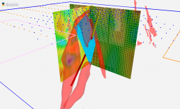
Dynamically links to EMIT’s Maxwell to simultaneously harness the power of both platforms. Once linked, you can broadcast plates within Maxwell to Geoscience ANALYST, adjust the geometry and parameters in Geoscience ANALYST, and broadcast the updated, linked plate to Maxwell.
Features
- Live connection to Electromagnetic Imaging Technology’s Maxwell software
- Manipulate plate geometry directly in the viewport or with visual parameters panel
- Broadcast most plate geometry, visual parameters, and data updates to and from Maxwell
- Provide Maxwell with a multi-disciplinary, immersive environment for more accurate plate modelling
- Provide a user interface capable of working with EM data
Execute forward modelling and unconstrained inversion of potential fields data. These basic geophysical functions are powered by our unique VP technology that can act directly on geological models. There are no limitations on model size. Also includes 2D Fourier grid filters and geophysical survey design.
Features
- Fourier filtering of 2D grid properties, including: high/low pass, reduction to pole, vertical/horizontal derivative, apparent susceptibility, apparent density, tilt angle, upward/downward continuation and strike
- Data trend removal (1st-, 2nd-, 3rd-order polynomial) for 2D Grid and Points objects
- Potential fields forward modelling and unconstrained inversion: gravity, magnetics, and gravity gradient
- Block Model designer to build a Block Model with the ability to set increasing cell size with depth
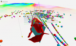
- EM loop modelling, data set, and associated decay curves panel for data analysis, quality control, and data filtering
- Survey designer to create ground or airborne survey observation points
Pro Geophysics
For advanced but easy-to-use geophysical interpretation with the suite of codes developed by the UBC Geophysical Inversion Facility (GIF), Geoscience ANALYST Pro Geophysics has been developed. It includes VPmg and VPem1D programs, combining industry-standard UBC technology with the unique capability of directly inverting for geological models that is provided by the VP Geophysics Suite. “How to” videos available on Mira Geoscience’s YouTube channel.
Geoscience ANALYST Pro Geophysics is sold on a 1-year subscription basis through membership in the Geoscience ANALYST Geophysics Pro Consortium; technical support and updates are included. Individual, corporate, academic, and non-profit licensing is also available.
- Ability to interact with UBC-GIF programs (programs not included)
- VPmg and VPem1D programs included
These programs are not included and must be purchased separately.
- Prepare data, create meshes, constrain inversion with geological information, run inversions, and visualize results
- Programs run locally or files are created for running remotely on-premise or cloud-hosted
VPmg and VPem1D programs are included:
- 3D modelling and inversion for gravity, gravity gradient, TMI, and magnetic gradient data
- Geologically-constrained and unconstrained inversion. Constraints include drillhole pierce points on contacts, downhole measurements of physical properties, and more
- Create geological models by assigning each cell to a geological unit
- Geometry of contacts, as well as density or susceptibility of geological units can be adjusted via inversion
- Density or susceptibility can be homogeneous or heterogeneous in each geological unit
- VPmg offers multiple ways of handling remanent magnetization through direct inversion of remanent magnetization parameters and inversion of derived data types