GOCAD® Mining Suite3D geological modelling software
This software, focused on Geology, compiles, models and analyses for valid interpretation honoring all existing data. It provides geological understanding for sound decisions.
“GOCAD Mining Suite is a versatile and continuously evolving platform that supports the advanced interpretation and integrated targeting methodologies needed for the next generation of undercover discoveries.”
Jamin CristallPrincipal Geophysicist – Anglo American
“This software provides the tools for developing 3D models in a controlled manner while being able to integrate and interrogate all data sets effectively."
Ian E NeilsonConsultant - Structural Geology
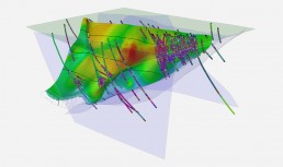
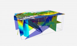
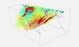
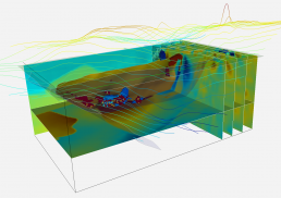
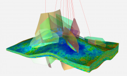
An industry-leading platform, GOCAD Mining Suite provides 3D earth models tools handling geological, geophysical, geochemical, geotechnical and structural data. It specializes in the subsurface modelling of challenging environments within the realms of exploration, resource assessment, mine sites, and geotechnical modelling. It is the leading 3D geological software for structural modelling, excelling even where drillhole control is minimal or non-existent. It exceeds in geologically-based 3D inversion and geophysical modelling, complex stratigraphic and fault modelling, geotechnical rock mass modelling and hazard assessment.
GOCAD Mining Suite is a customized extension of SKUA-GOCADTM developed for the petroleum industry by Emerson Paradigm Holding LLC. It’s designed for integrated 3D model-building across all commodity types and geological environments, leveraging the core ability to import, create, and integrate data of all types in a single environment. It is a true 3D GIS, where objects can be built, imported, edited, queried, and visualized. It allows asset teams to develop, share, and collaborate on data, information, and models regardless of their respective discipline.
The price of a licence depends on the 3D modelling software selection that is made to fit your individual needs best. Academic and non-profit licensing is also available.
Geoscience Exploration Package
This package is for you if you are looking for a true 3D GIS environment, and want to build regional, project or deposit scale 3D models while better managing risk, timelines and costs. This includes compiling and integrating historical data and regular updating of models with new information from disparate multidisciplinary sources, including drilling, outcrop measurement, surface sampling, physical properties, lithology, geochemistry, assays, structural measurements, and geophysics.
- Provides the basic viewing camera, selection, querying, interrogating, and navigation of a project and data in 3D space.
- Provides visual digitizing and querying of all types of objects in 3D space.
- Faster processing for voxets and the use of all computer cores to support heavy voxet operations.
- Maps: Fast, professional, and flexible layouts and style templates.
- Cross-sections: Includes grid extraction and deviated well tracks (facies, log, image, etc.), solid filling according to rock classifications and markers, print to scale with annotations, 3D fence sections, drillhole pillars for vertical holes, link to 3D camera, style templates.
- Well-sections, section from well collars, well tracks and overlay, style templates.
- Extensive mining-industry import/export filters.
- Mining-specific applications and functions, e.g. drillhole designer.
- Visualize, interpret, and query geometry and properties on drillhole logs including discrete and continuous properties.
- Spatial and property queries on objects (proximity, trend, inclusion, intersection, etc.)
- Nested and Boolean operations.
- Metadata editor.
- Tabular information display interactive with 3D visualization.
Advanced Interpretation Package
The focus of this package is on multi-disciplinary construction, visualization, querying and interpretation of 3D models and data. It includes the full capability of the Geoscience Exploration Package plus the ability to digitize and edit 2D cross-sections, multi-parameter interrogation of block models, and geostatistical interpolation, estimation, and simulation. Adding the optional ioGAS-GOCAD Mining Suite Link presents a powerful configuration for querying, interrogating, and visualizing geochemical and alteration signatures in 3D.
This package includes the Geoscience Exploration modules plus the following modules:
- Digitizing/editing on cross-sections, strip logs, and maps synchronized with features; flattening at drillhole markers.
- Automated drillhole correlation using the stratigraphic column.
- Drillhole log ghosting, editing, and zone manipulation.
- Export drillhole logs to CSV.
- Advanced block model visualization.
- Voxet interrogation probe via 3D box, property co-rendering (up to three at a time), real-time slicer, fence cross-section, arbitrary user-defined axis.
- User-defined restricted view of open data (points, lines, surfaces, volumes etc.) in 3D camera window rendered to probe surface; includes 3-property co-rendering.
- Seismic data: full interpretation workflow with auto-picking and tracking in 2D/3D, cross-sections (maps) from probes.
- Kriging estimation engine for geostatistical estimation and simulation on 2D/3D grids and triangulated surfaces.
- Works in concert with variogram analyser e.g. auto-fitting, coordinates transform.
- Deformed grid geostatistics: a better way to unfold data properly.
- Creates velocity models that integrate complex structures
- Performs time to depth conversion.
Geotechnical Modelling Package
Disparate data sources are integrated into a single 3D model for geotechnical modelling as well as hazard assessment. It includes the full capability of the Advanced Interpretation Package plus specific functionality for complex querying, targeting, and 3D identification of geotechnical hazards.
This package includes the Geoscience Exploration modules, Advanced Interpretation modules plus the following modules:
- Geotechnical hazard estimation, identification, and monitoring.
- Geohazard dashboard.
- Import and include multi-disciplinary mining data into 3D integrated models.
- Geohazard identification using point, curve, region, surface, and grid/voxet data types.
- Combination, inclusion or exclusion, and proximity-based querying.
- Knowledge-driven and data-driven approaches.
- 3D visual reference, reporting, and auditable workflow.
- Download Targeting Workflow Module’s PDF
Integrated Modelling Package
This package was made to allow integrated modelling work at regional, deposit, or project scale. It is including the full capability of the Advanced Interpretation Package, adding to it an implicit fault network builder and specific functionality for leveraging multi-disciplinary data with variable, sparse or discontinuous spatial coverage for integrated 3D mineral exploration targeting and potential modelling. Faulted horizons can be implicitly modelled, and updated or adjusted using a vast array of explicit editing/creation tools in 3D or in 2D cross-sections. Adding the optional ioGAS-GOCAD Mining Suite Link presents the ideal configuration for querying, interrogating, visualizing, and targeting geochemical and alteration signatures.
This package includes the Geoscience Exploration modules, Advanced Interpretation modules and the following modules:
- Implicit modeling of complex fault networks and stratigraphic horizons with or without drillhole data.
- Allows overturned folds as well as reverse and dying faults, etc.
- Works in tandem with a stratigraphic column and includes depositional relationships between formations.
- Leverages multi-core processing capability for rapid processing.
- Download SKUA Structure with Multi-Core Processing Module’s PDF
- 3D mineral potential targeting using point, curve, region, surface, and grid/voxet data types.
- Combination, inclusion or exclusion, and proximity-based querying.
- Knowledge-driven and data-driven approaches.
- 3D visual reference, reporting, and auditable workflow.
- Download Targeting Workflow Module’s PDF
- Quickly build 3D surfaces from sparse datasets.
- Quickly build 3D geology models from surface data only.
- 3D Structural Fields Interpolator supporting bedding and foliation data.
- Parametric interpolators: NURBS, Bezier, Hybrid.
- Download Sparse’s PDF
Advanced Geophysics Package
Designed primarily for geophysicists, it is also exceptionally functional for structural geologists. It includes the full capability of the Advanced Interpretation Package plus specific functionality for geophysical inversion, interpretation, and rapid structural geology incorporation, which is critical to the constrained geophysical inversion process. Unique geologically-driven inversion software (VPmg) is included. This is the only software package available anywhere that enables the construction of geological models fully consistent with any available geological and geophysical data.
This package includes the Geoscience Exploration modules and Advanced Interpretation modules plus the following modules:
- Implicit modelling for stratified geological settings.
- Builds complex fault networks and stratigraphic horizons.
- Allows overturned folds as well as reverse and dying faults.
- Works in tandem with a stratigraphic column and includes depositional relationships between formations.
- Leverages multi-core processing capability for rapid processing.
- Download SKUA Structure with Multi-Core Processing Module’s PDF
- Constrained inversion code operating directly on the geologic model.
- 3D gravity and gravity gradient inversion and forward modelling.
- 3D magnetic and magnetic gradient inversion and forward modelling.
- 3D self-demagnetization.
- Airborne 1D TEM inversion program with the same geometry inversion approach used by VPmg.
- Advanced modelling and inversion for gravity and magnetics.
- Leverages 3D geological models, structure, geometry, and physical properties as inversion constraints.
- Works seamlessly with VPmg and UBC-GIF MAG3D and GRAV3D inversion codes.
- Download Potential Fields Module’s PDF
- Modelling and inversion for electrical and electromagnetic data.
- Electrical: Inversion, forward modelling, and editing of 2D and 3D DC Resistivity and Induced Polarization (IP).
- Electromagnetics: Inversion, forward modelling, and editing of time-domain airborne EM.
- Leverages 3D geological models, structure, geometry, and physical properties as inversion constraints.
- Works seamlessly with VPem1D, VPem3D as well as UBC-GIF DCIP2D, DCIP3D, EM1DTM, EM1DFM inversion codes.
- 3D forward modelling for hard rock environments (2D and 3D synthetic seismograms).
- Models seismic reflections data using 3D geological and physical properties models.
- 2D forward modelling and inversion provides straight and curved ray time-travel within discretized 2D planes.
Stratigraphic Modelling Package
This is a specific package destined to the modelling of stratified depositional environments and ore bodies with folded and/or faulted 3D grids in a stratigraphic space. It is a comprehensive offering that includes the full capability of the Advanced Interpretation Package plus industry-leading stratigraphic and structural implicit modelling. It contains complete geostatistics for resource modelling and estimation for stratified ore bodies, as well as structural restoration capability.
This package includes the Geoscience Exploration modules and Advanced Interpretation modules plus the following modules:
- Implicit modelling for stratified geological settings.
Builds complex fault networks and stratigraphic horizons. - Allows overturned folds as well as reverse and dying faults.
- Works in tandem with a stratigraphic column and includes depositional relationships between formations.
- Leverages multi-core processing capability for rapid processing.
- Download SKUA Structure with Multi-Core Processing Module’s PDF
- Implicit modelling of 3D geological grids for stratified geological settings.
- Builds the optimum grid for geostatistics; faulted and folded grids with parametric space equivalent.
- Leverages fault networks and horizon grid outputs from SKUA Structure.
- Provides the ideal grid for stratified deposit geostatistics and volumetric computation.
- Leverages multi-core processing capability for rapid processing.
- Download SKUA Structure with Multi-Core Processing Module’s PDF
- 2D and 3D geostatistical estimation and simulation workflows.
- Works with both continuous and discrete properties.
- Advanced search ellipsoid parameters.
- Post-processing functionalities for simulations.
- Wide variety of kriging and simulation methods.
- Proper geostatistical domain blending.